3D laser scanning in the Netherlands is widely used to capture physical environments with a high level of accuracy. By emitting laser pulses and recording their reflections, this technology creates detailed three-dimensional datasets that support reliable analysis and decision-making.
What 3D laser scanning involves
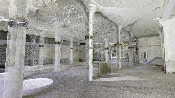
3D laser scanning involves the use of terrestrial or mobile laser scanners to collect millions of measurements in a short time. Each scan records exact spatial coordinates, producing a dense and highly accurate digital representation of the scanned environment.
Why 3D laser scanning is essential in the Netherlands
The Netherlands features dense urban areas, complex infrastructure, and strict building standards. 3D laser scanning allows professionals to document existing conditions accurately, which is essential for renovation, infrastructure upgrades, and redevelopment projects.
Accuracy and efficiency advantages
Compared to traditional surveying methods, 3D laser scanning delivers higher precision and full spatial coverage. Once data is captured, measurements can be extracted digitally without repeated site visits, reducing time and operational costs.
Integration with BIM and CAD workflows
3D laser scanning data integrates seamlessly with BIM and CAD platforms. This enables the creation of accurate as-built models, verification of dimensions, and early detection of design conflicts across multidisciplinary teams.
Long-term value of laser scanning data
Laser scanning datasets remain valuable beyond the initial project. They support future modifications, maintenance planning, and asset management, making them a strategic digital asset for projects across the Netherlands.